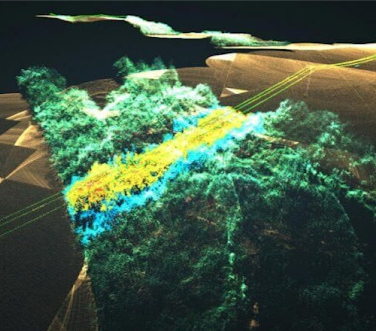
When you look at a forest, you see trees. When AI analyzes the same LiDAR point cloud data, it detects subtle canopy stress patterns, early disease signs, and micro-topographical features that predict erosion risk, all invisible to human perception. This pattern recognition transforms how organizations make critical decisions about infrastructure, environmental management, and resource allocation.
The concept of "hidden patterns" in spatial data isn't mystical, it's about mathematical relationships and multi-dimensional features beyond our sensory limitations. While humans excel at recognizing familiar objects, AI systems process millions of data points simultaneously, detecting subtle variations that would take human analysts weeks to identify.
Seeing Through Complexity
Point cloud data presents what data scientists call the "curse of dimensionality", each point contains multiple attributes including X, Y, Z coordinates, intensity values, return number, number of returns, and classification codes. A LiDAR dataset might contain dozens or hundreds of points per square meter, with each point carrying 10 distinct attributes. For human analysts, this creates an overwhelming matrix of millions of data points across multiple dimensions.
AI systems approach this complexity fundamentally differently. Rather than trying to visualize or manually interpret patterns, machine learning algorithms construct mathematical models that operate natively in high-dimensional space. These models identify feature combinations that would be impossible for humans to detect through visual inspection.
Consider surface roughness analysis on building rooftops. A human inspector might categorize a roof as "smooth" or "rough" based on visual appearance, but AI simultaneously calculates statistical measures like standard deviation of point heights, local planarity coefficients, surface normal vector variations, and spatial autocorrelation patterns. The algorithm might discover that roofs with specific combinations of these mathematical properties, perhaps low height variation but high normal vector dispersion, consistently indicate early-stage material degradation that isn't yet visible to human observers.
The power lies in detecting subtle statistical signatures across multiple dimensions simultaneously. AI might identify infrastructure stress by recognizing that point distributions deviate from expected geometric models in ways that correlate with structural loading patterns, material fatigue, or environmental exposure effects.
Contextual Understanding and Spatial Relationships
Modern AI systems excel at learning complex spatial relationships that extend far beyond individual point properties. This contextual understanding emerges through deep learning architectures that process point clouds hierarchically, building understanding from local geometric features up to scene-level semantic relationships.
The learning process begins with local neighborhood analysis, where algorithms examine how each point relates to its immediate surroundings. These local features, such as surface normals, curvature measures, and local point density, become building blocks for higher-level pattern recognition. The next layer identifies object-level features by aggregating local patterns: recognizing that certain combinations of surface orientations, point densities, and geometric relationships consistently indicate specific object types.
At the highest level, AI systems learn contextual rules that govern how objects relate within broader scenes. The algorithm learns that power lines typically maintain consistent elevation relationships with terrain, that buildings cluster in predictable patterns relative to road networks, and that vegetation exhibits specific spatial relationships with topography and water features.
This hierarchical understanding enables sophisticated anomaly detection. When AI encounters geometric patterns that violate learned spatial relationships, such as vegetation appearing at elevations where it shouldn't survive, or infrastructure elements positioned in geometrically impossible configurations, it flags these areas for investigation. The system doesn't just identify what objects are present; it understands whether their spatial relationships make sense within the broader scene context.
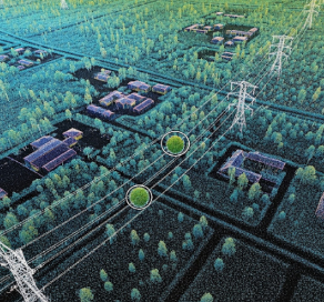
Applications in Infrastructure and Environmental Monitoring
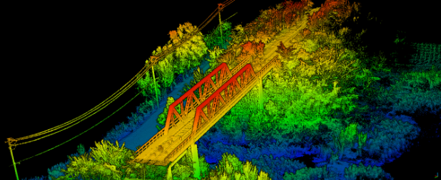
In infrastructure monitoring, AI systems analyze geometric deviations that precede visible structural problems by months or years. Bridge inspection provides a compelling example. Traditional methods rely on visual inspection of obvious damage like cracks, rust, or displacement. AI-driven analysis examines millions of points across bridge surfaces, calculating mathematical properties like local planarity, surface continuity, and geometric regularity. The system learns to recognize subtle statistical signatures that indicate stress concentration areas, material fatigue, or foundation settlement, often detecting problems when they're still in early stages and cost-effective to address.
For environmental monitoring, AI's pattern recognition capabilities enable detection of gradual ecosystem changes that unfold over extended time periods. Forest health assessment moves beyond simple tree counting to analyze complex spatial patterns in canopy structure, understory density, and species distribution. The system identifies subtle changes in forest composition that might indicate disease spread, invasive species pressure, or climate adaptation responses.
Coastal monitoring demonstrates AI's ability to detect long-term geomorphological processes. By analyzing temporal sequences of point cloud data, AI systems track beach profile evolution, dune migration patterns, and erosion rates with centimeter-level precision. These measurements reveal process dynamics that would require years of manual surveying to document, enabling proactive coastal management decisions.
##From Pattern Detection to Actionable Intelligence The ultimate value of hidden pattern detection lies in translating complex spatial insights into concrete operational decisions. Modern AI systems integrate pattern recognition with decision support frameworks that convert detected anomalies into prioritized action plans.
Consider a municipal infrastructure department managing thousands of kilometers of roads, bridges, and utilities. AI-driven point cloud analysis continuously monitors infrastructure conditions, detecting subtle geometric changes that indicate developing problems. When the system identifies statistical signatures associated with pavement failure, it doesn't just flag problem areas, it integrates with asset management databases to estimate remaining service life, calculate repair costs, and optimize maintenance scheduling.
The decision support process incorporates multiple factors beyond pattern detection. AI systems learn to weight detected anomalies based on criticality, accessibility, budget constraints, and operational impacts. A bridge showing early stress indicators might receive high priority due to safety implications, while similar patterns in secondary infrastructure might be scheduled for routine maintenance cycles.
This integration transforms pattern detection from an analytical exercise into operational intelligence that drives measurable improvements in efficiency, safety, and cost management.
The Future of Spatial Intelligence
The patterns exist in your data, AI systems like Iris help make them visible and actionable. For infrastructure managers, environmental scientists, and spatial analysis professionals, the opportunity lies in incorporating environmental understanding with predictive, intelligence-driven strategies. The question isn't whether AI can detect hidden patterns in your spatial data, it's whether your organization is ready to act on the insights these patterns reveal.
Ready to discover what hidden patterns exist in your point cloud data? Contact us to learn how Iris can transform your spatial analysis capabilities and reveal insights that drive better decision-making.