Production AI Solutions
From autonomous target recognition to enterprise-scale point cloud processing, discover the solutions we've implemented using our products.
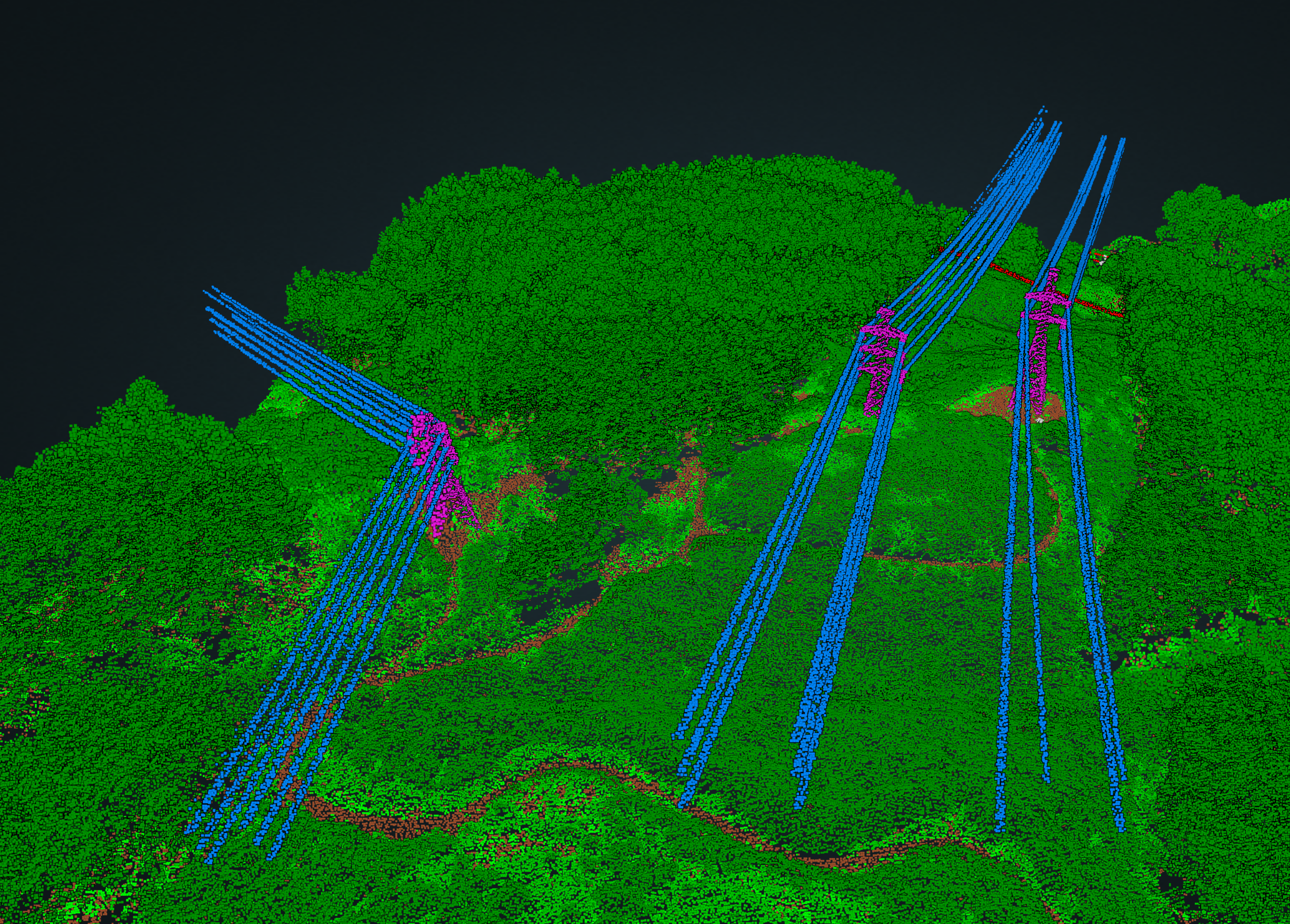
Infrastructure Corridor Mapping
Automated power line and vegetation classification with hazard detection to prevent encroachment.
Key Results
- 70% cost reduction
- 4× faster delivery

Riverine Classification Automation
Automated classification of complex riverine point clouds for accurate environmental and hydrographic modeling.
Key Results
- 12,740 personnel hours saved
- 70% reduction in processing time

Satellite-Enabled Feature Extraction
Full image segmentation for large-scale survey applications. Fast, precise object tracing and analysis across vast geographies.
Key Results
- Rapid deployment for regional surveys
- High-precision segmentation
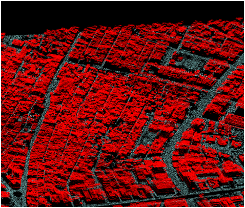
Topographic Feature Detection
Extracting ground, vegetation, and buildings in densely populated areas using topographic LiDAR.
Key Results
- 60% reduction in processing time
- High accuracy classification exceeding 40M points/min
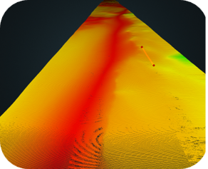
Multibeam Sonar Seabed Cleanup
Automating the identification of valid seabed vs. noise to eliminate manual 'killing dots' workflows.
Key Results
- Clear, accurate depth maps
- 90% reduction in processing time

Autonomous Drone Localization
Image-based geo-location using terrain-relative navigation.
Key Results
- Enabled mission-critical operations in GPS-denied areas
- Minimized lost drone incidence

Target Recognition
Automated identification of man-made objects and hazards using Side Scan and RGB-D data.
Key Results
- Detection rate > 90% across defence, survey, and hazard identification.
Have a similar challenge?
Let's discuss how we can apply our expertise to your specific problem
Discuss your project