Iris: Production-grade point cloud classification
AI-augmented classification that scales with your needs—no thresholds, no subcontractor relay race.
Legacy tools were built for gigabyte-era LiDAR
TerraScan macros and custom scripts choke on 100B+ points, need hand-tuned thresholds, and force tile-by-tile rework across subcontractors.
Result: you're trading speed, cost, and quality - scale one, the others crack.
Before Iris
- • 30-40 person classification teams
- • Weeks to classify large projects
- • Manual threshold tuning per tile
- • Inconsistent results across geographies
- • Expensive subcontractor relay race
After Iris
- • Lean QC-only team
- • Results in hours, not weeks
- • AI-augmented pipeline
- • Consistent across large areas
- • 90% cost reduction
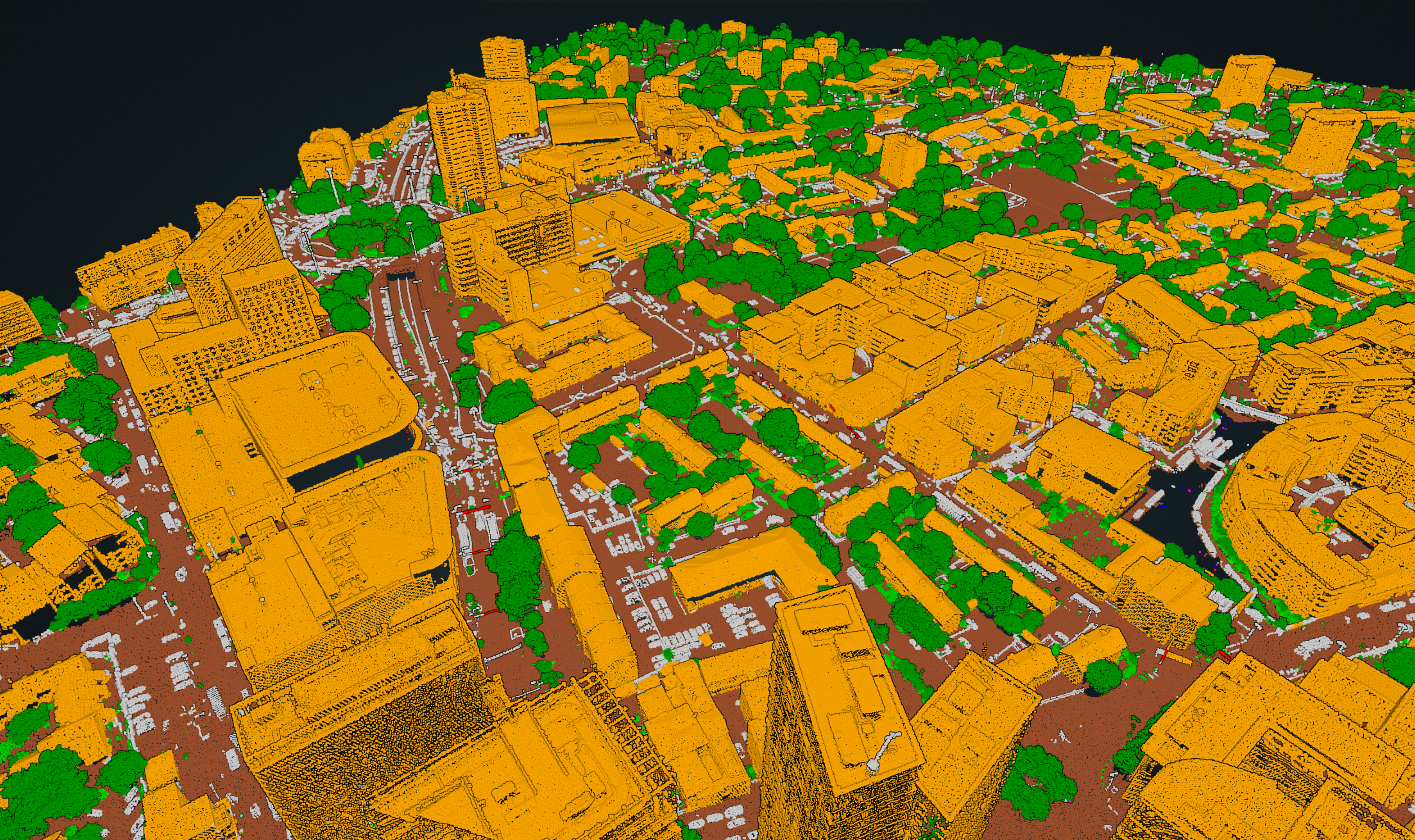
Built for Production
Consistent across large geographies
Zero tile drift; passes agency-grade specs with human-in-the-loop override
Processes 10-40 million points per minute on single GPU
QC-first automation
AI learns from corrections and handles complex terrain
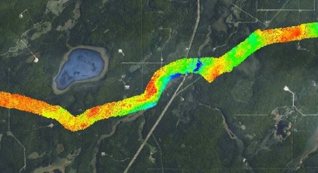
Bathymetric and terrestrial applications with multi-class classification
Drop-in workflow
Upload unclassified LAS, download QC-ready files within hours
Works with point clouds from any sensor—no vendor lock-in
Technical Specifications
Supported Formats
- LAS, LAZ
- E57
- PTS
Classifications
ASPRS standard classes including ground, buildings, vegetation, power lines, water surface, seabed, and more
Deployment Options
- On-premises
- Client cloud
- Iris Labs cloud
Customization
- Fine-tune on client data
- Custom class definitions
Applications
National mapping agencies

Infrastructure monitoring
Forestry & environmental
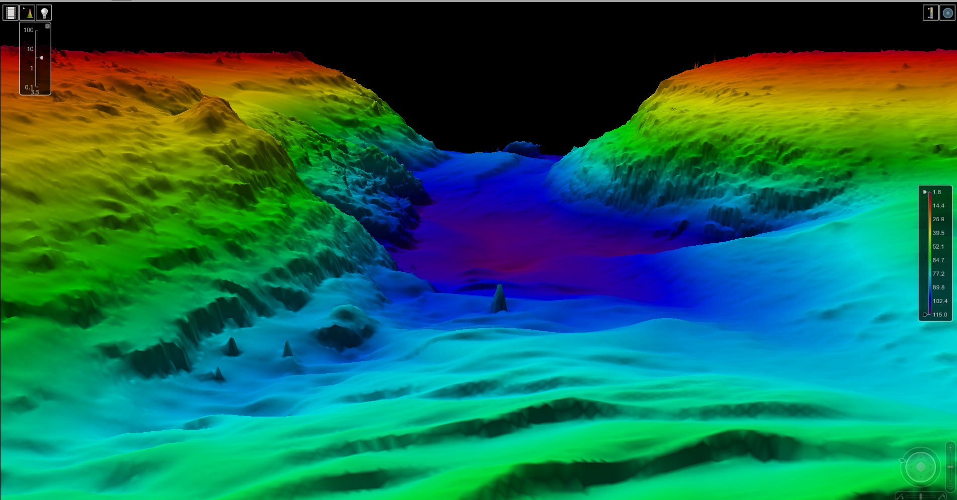
Bathymetric surveying

Urban planning
Corridor mapping
Real-World Results
Cost Reduction
Faster Delivery
Points Processed/Minute
Iris supports all major sensors

What comes next
Take it further with Iris Insights
Iris classifies. Iris Insights interprets.
Turn your classified point clouds into operational dashboards, risk scores, change reports, and conversational data access - no extra data prep required.
Operational Dashboards
Domain-specific KPIs, trend charts, and anomaly distributions — updated every classification run.
Geographic Risk Scoring
Spatial risk maps that prioritise where your operations team should act first.
Chat with Your Data
Ask plain-language questions about your classifications and get cited, actionable answers instantly.
Ready to transform your point cloud pipeline?
Iris was built solving real-world classification challenges for our partners. Complex terrain? Custom specs? Legacy data? We've solved it before.