City scans that once chewed up two weeks of manual labeling now finish in three hours, thanks to GeoAI point-cloud classification.
In today's data-rich world, our ability to capture the physical environment in precise digital detail has never been greater. Point cloud data—those dense collections of 3D coordinates that represent physical spaces—has become an invaluable resource across industries ranging from architecture and construction to autonomous navigation and environmental monitoring. Yet as our capacity to collect this data has grown exponentially, so too has the challenge of processing and extracting meaningful insights from these massive datasets.
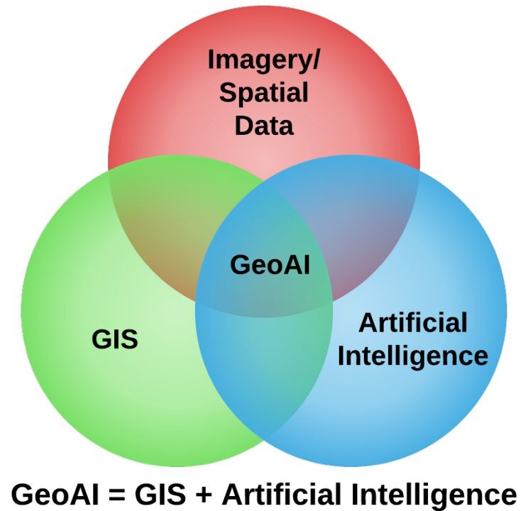
This is where the emerging field of GeoAI—the integration of artificial intelligence with geospatial data and analysis—promises to fundamentally transform what's possible. The marriage of AI with point cloud analysis is creating unprecedented opportunities to understand and interact with our physical world. In this post, we'll explore how machine learning techniques are positioned to revolutionize point cloud classification and open new frontiers for spatial intelligence.
The Point Cloud Classification Challenge
Traditional approaches to point cloud classification have long relied on geometric rules, hand-crafted features, and labor-intensive manual processes. Analysts often painstakingly segment point clouds and apply rule-based algorithms to identify objects like buildings, vegetation, or terrain. While effective for most scenes, these methods quickly reach their processing time and robustness limits when faced with increasingly complex environments.
The challenges are multifaceted:
-
Varying point densities create inconsistencies across datasets, with some areas captured in fine detail while others remain sparse. Consider an urban lidar scan where building facades might contain thousands of points per square meter, while more distant objects might have just a handful of points representing their entire structure.
-
Occlusion and viewpoint limitations mean that parts of objects are often hidden or incomplete in the data. A tree might partially obscure a building, or the underside of a bridge might be captured from only one angle, creating "shadows" in the point cloud.
-
Similar-looking objects confound simple geometric rules. The flat surface of a road might appear geometrically similar to a rooftop when viewed in isolation, requiring contextual understanding to differentiate reliably.
As datasets grow to billions of points, manual classification becomes not just inefficient but effectively impossible. A single citywide scan might contain tens of billions of points—far beyond what human analysts can process in any reasonable timeframe. The industry clearly needs a paradigm shift, and GeoAI represents that transformative opportunity.
Core AI Technologies Driving the Transformation
The breakthrough potential lies in deep learning approaches specifically designed for 3D spatial data. Unlike traditional data processing where information often follows predictable patterns and structures, point clouds present unique challenges with their unordered, irregular nature and massive scale.
Modern AI systems are being developed to handle these complexities in ways that mirror human spatial reasoning. Just as experienced analysts intuitively understand how to interpret spatial relationships and context, these AI models are learning to recognize geometric patterns and spatial structures directly from raw point cloud data.
The key advancement is that these systems can process points in their native 3D format without requiring conversion to intermediate representations like grids or meshes—formats that can introduce artifacts or lose important spatial details. This direct processing approach preserves the full richness of the original data capture.
What makes these AI approaches particularly promising is their ability to understand context and patterns across multiple scales simultaneously. Much like how an experienced analyst can examine data at different zoom levels to understand both local details and broader spatial patterns, these systems can:
- Learn to recognize patterns that distinguish complex natural features from simpler built infrastructure
- Understand that points forming continuous surfaces likely represent the same geographic object or feature
- Develop robust interpretations that work across varying data quality and density conditions
- Adapt their understanding as they encounter new geographic environments and feature types
Perhaps most valuable for spatial workflows, these systems have the potential to improve continuously as they process more data. Unlike traditional rule-based classification approaches that require manual updates for new scenarios, AI models could automatically refine their spatial understanding, learning to handle new geographic contexts and feature types as they encounter them.
The Potential for Real-World Impact
The transition to AI-powered classification promises remarkable practical benefits.
Classification accuracy could see dramatic improvements, with emerging systems showing potential for over 95% accuracy for common object categories—a substantial leap from the 60-70% typical of traditional methods. This could translate directly to more reliable analysis and fewer costly errors.
The efficiency gains could be equally impressive. Projects that currently require weeks of manual classification might be completed in hours. Early adopters are already reporting potential workflow reductions from two weeks to just three hours—a 98% reduction in processing time.
Perhaps most exciting are the new capabilities that could emerge from this technology. Organizations may soon be able to:
- Automatically detect and classify objects that are currently too subtle or complex for automated systems
- Create semantically rich 3D models that distinguish dozens of object categories
- Support real-time classification for mobile mapping and autonomous navigation applications
- Process historical data at scale, unlocking value from previously underutilized datasets
Consider a utility company that currently spends months manually identifying potential vegetation encroachments on power lines. With AI classification, they can monitor their entire network continuously, receiving early warnings about potential hazards before they cause outages.
Preparing for AI Point Cloud Classification
For organizations looking to position themselves for AI-powered classification, several considerations can help ensure readiness:
Data quality will remain paramount. While AI systems can potentially handle imperfect data better than traditional methods, they will still require representative training examples. Organizations should begin by assessing their existing data assets and potentially investing in high-quality training datasets for their specific domains.
Starting with well-defined use cases rather than attempting to solve every classification challenge at once will be crucial. For example, a transportation department might focus initially on road surface classification before expanding to more complex roadside assets.
When considering future implementation pathways, organizations will typically have three options:
- Build custom solutions tailored to specific needs (requiring substantial AI expertise)
- Buy commercial platforms that offer pre-trained models and customization options
- Partner with specialized firms that can provide both technology and domain expertise
The right choice will depend on internal capabilities, the specificity of needs, and available resources. Many organizations may find that starting with commercial solutions for common classification tasks allows them to demonstrate value quickly, while gradually developing more specialized capabilities.
The Transformative Potential of GeoAI
The integration of AI into point cloud classification represents far more than an incremental improvement—it's a fundamental shift in how we could interact with spatial data. Tasks that are currently prohibitively time-consuming or technically infeasible could become routine, and the accuracy of these systems continues to show remarkable improvement potential.
Looking ahead, several exciting trends are emerging on the horizon:
- Multi-modal fusion approaches that could combine point clouds with imagery, thermal data, and other sensors to create even more comprehensive understanding
- Explainable AI techniques that may help users understand classification decisions, building trust and enabling more effective human-AI collaboration
- Interactive AI systems that could allow users to query point cloud environments conversationally, asking questions like "show me all the buildings over 50 feet tall" or "identify potential flood risk areas"
The democratization of these GeoAI technologies promises to make advanced spatial intelligence accessible to organizations of all sizes, not just those with specialized expertise or extensive resources.
–--
Interested in learning more about Iris? Connect with us on LinkedIn or email us!