We build deployable GeoAI systems
When complex geospatial technology demand more than off-the-shelf tools, we bring expertise that ships.
Trusted by our customers and partners
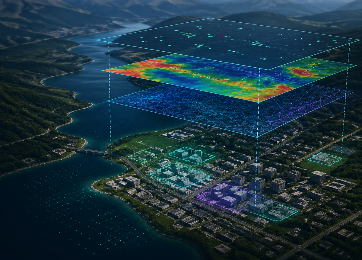
Deployable AI for Geospatial Data
From point cloud classification to autonomous target recognition, our products demonstrate technical depth built for the hardest problems.
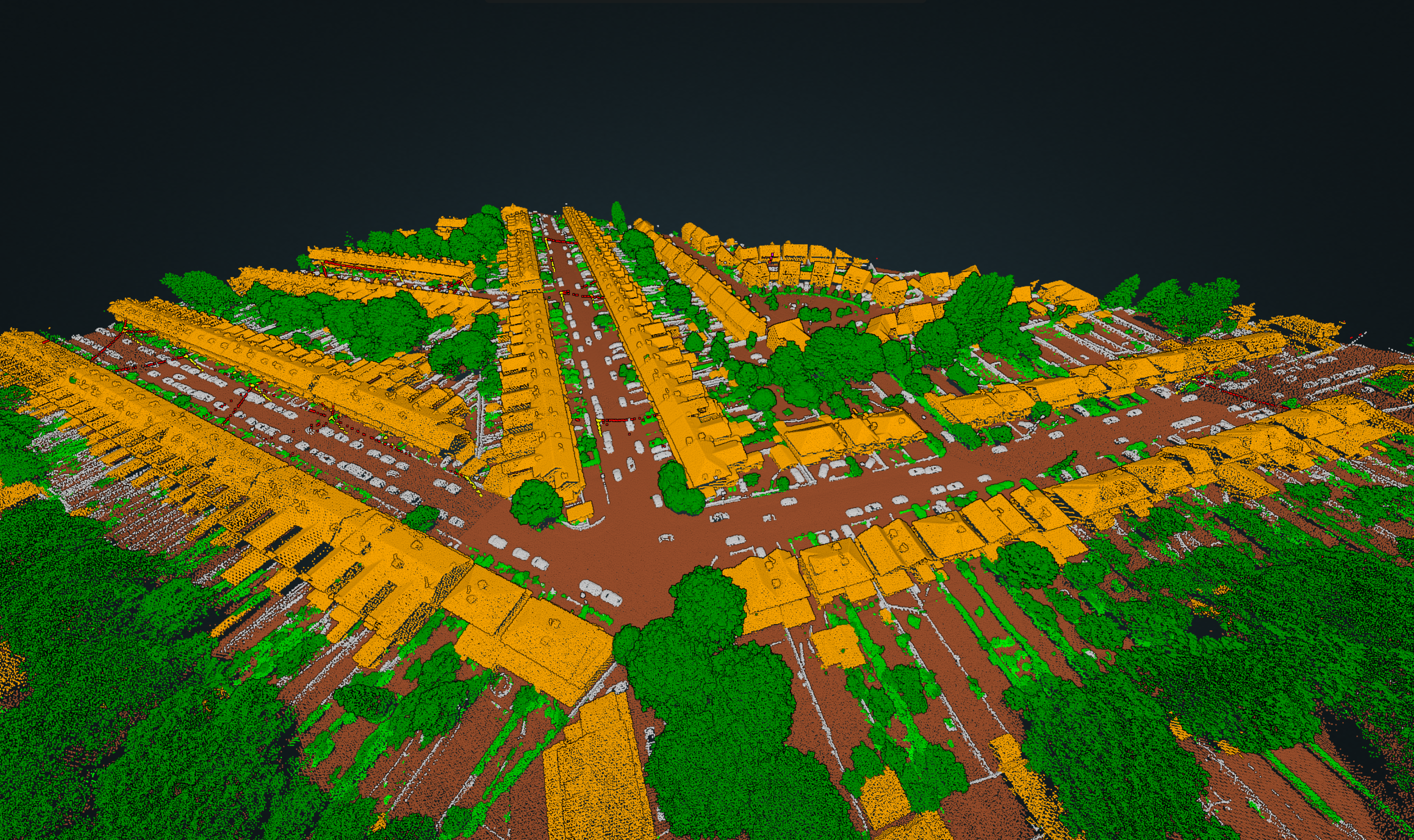
Iris
Point Cloud Intelligence
AI-driven classification for LiDAR and point cloud data. QC-ready results in hours, not weeks.
Explore Iris
Lumen
Image Intelligence
Automated feature extraction with sub-meter accuracy. Lumen has provided insights on imagery collected from space to the sea floor and everywhere in between.
Explore Lumen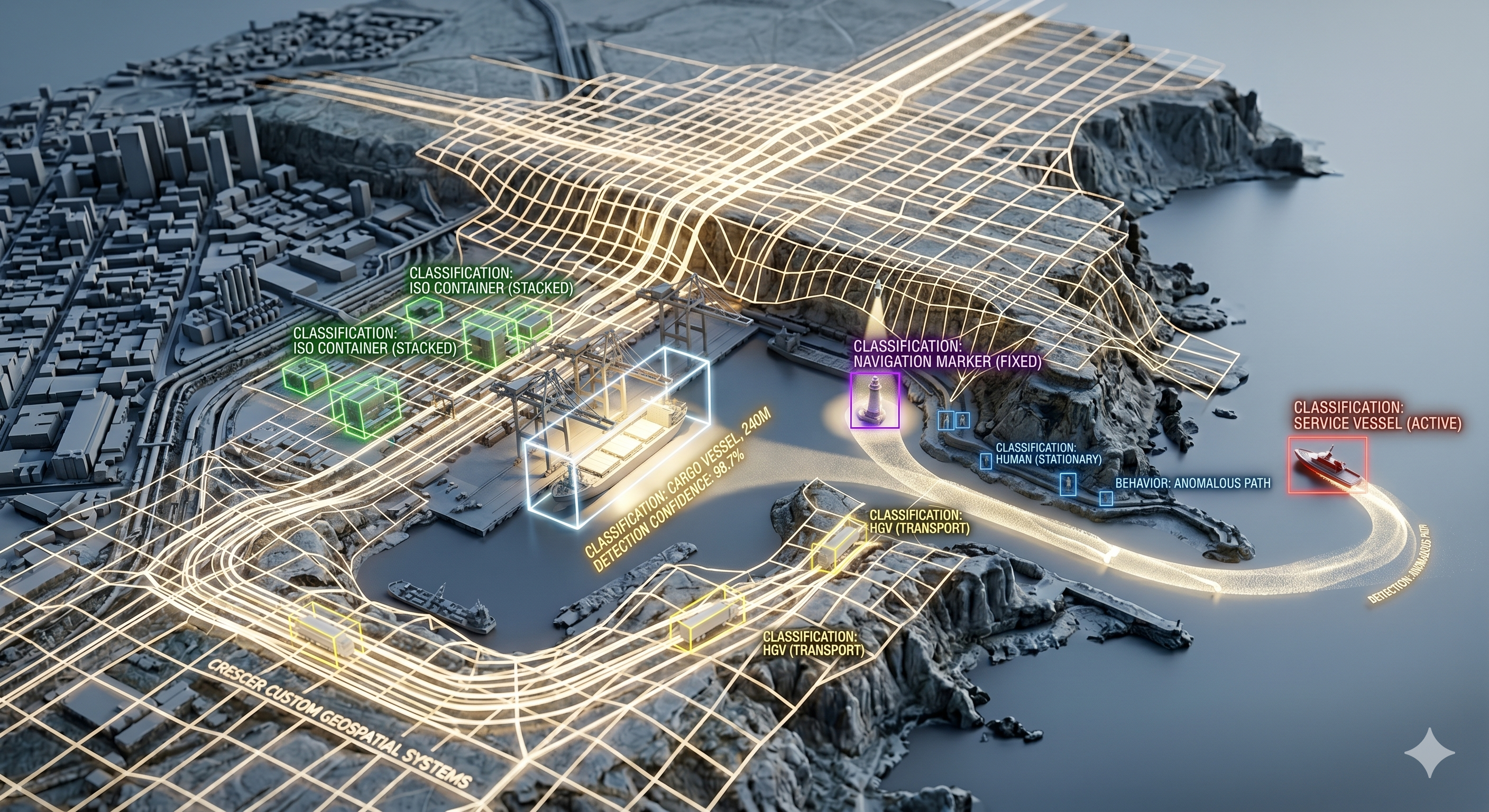
Custom Solutions
Tailored AI Systems
Production AI for your unique geospatial challenges. From target recognition to robotic navigation, we've done it all.
Partner with us
Proven at Scale
Real results for real customers with demanding requirements
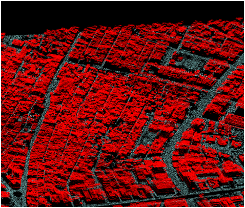
Topographic Feature Detection
Extracting ground, vegetation, and buildings in densely populated areas using topographic LiDAR.

Riverine Classification Automation
Automated classification of complex riverine point clouds for accurate environmental and hydrographic modeling.
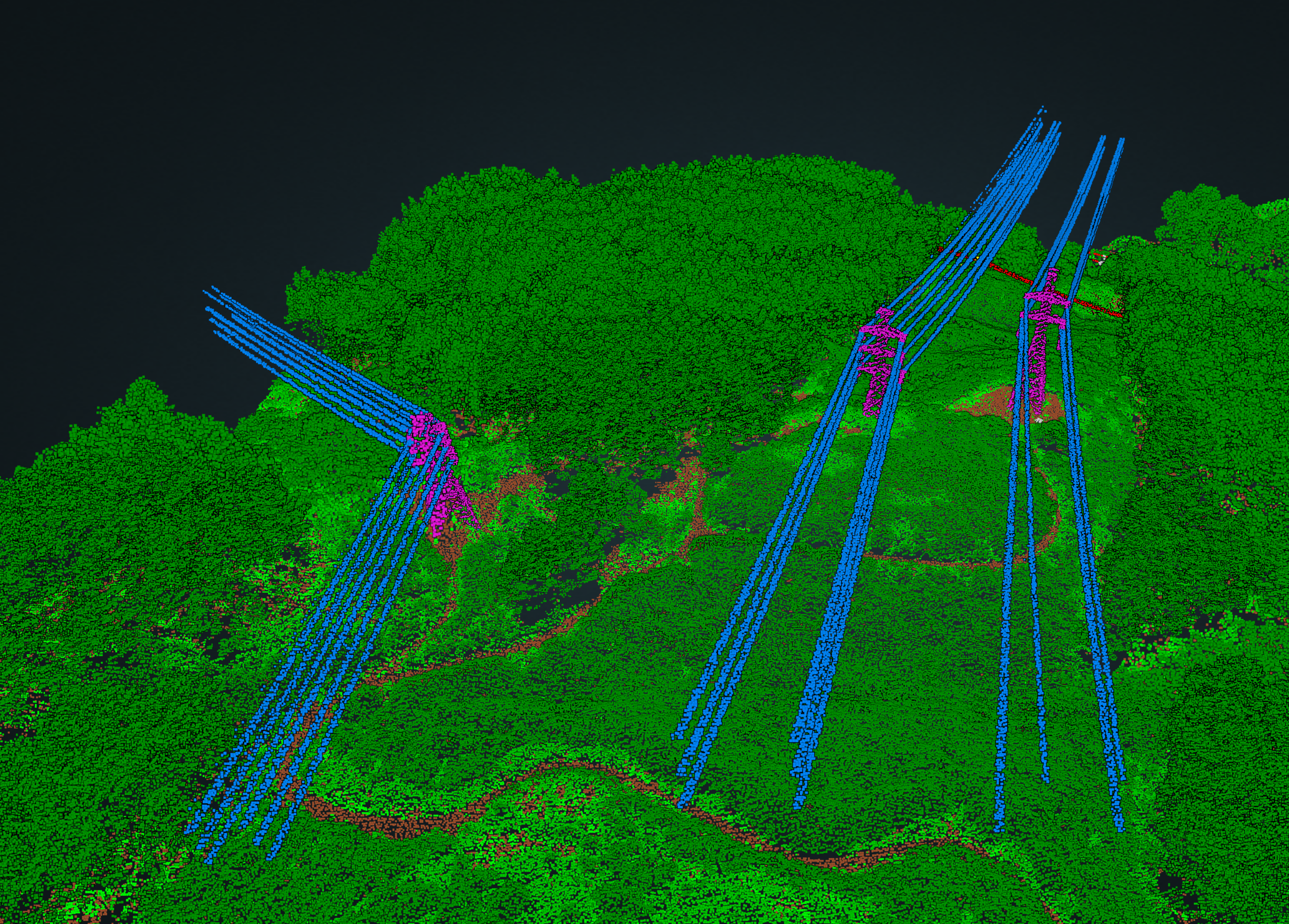
Infrastructure Corridor Mapping
Automated power line and vegetation classification with hazard detection to prevent encroachment.
Ready to solve your geospatial AI challenge?
Whether you're facing a point cloud processing bottleneck, need custom AI for autonomous systems, or have a unique problem—we'd like to hear about it.
Discuss your project